GPS and Apps for Ipad

Prospecting Australia

Help Support Prospecting Australia:

This site may earn a commission from merchant affiliate links, including eBay, Amazon, and others.
Diggerdude said:
G'day West Aussie, I also had errors when I first got the app. It was a problem with the local connect program not being able to convert the files. They emailed me another version of the program and it all works fine now. Let me know if you don't get it sorted and I can give you a download link I have for it.

DD


any chance you can post the URL for the improved app DD ?

sounds like the missing link :D
 
Diggerdude said:
G'day West Aussie, I also had errors when I first got the app. It was a problem with the local connect program not being able to convert the files. They emailed me another version of the program and it all works fine now. Let me know if you don't get it sorted and I can give you a download link I have for it.

DD

Hi DD,

If you would be so kind to post a link for your version of the local connect program that would be much appreciated. Gisroam support are adamant that the map images from the WA Dmp will not work.

West Aussie
 
Ramjet said:
My recommendation... throw out the fruit machine and get an Android :D ;)

Rod

well i bought an Ipad mini WiFi + cell

So far i have spent 6 hours trying to set it up , and 2.5 hours on chat to apple tech support

despite following the user guide i cant get bookmarks , files or folders to import into ipad

after 2.5 hrs on chat to them their " geniuses " cant even tell me how to import bookmarks into Ipad from my comp , nor how to import files or folders in to Ipad that i want to use with google earth

nuthin has changed . its just like dealing with telstra

hahaha :D
 
West Aussie said:
Diggerdude said:
G'day West Aussie, I also had errors when I first got the app. It was a problem with the local connect program not being able to convert the files. They emailed me another version of the program and it all works fine now. Let me know if you don't get it sorted and I can give you a download link I have for it.

DD

Hi DD,

If you would be so kind to post a link for your version of the local connect program that would be much appreciated. Gisroam support are adamant that the map images from the WA Dmp will not work.

West Aussie


I will have a hunt back through my emails for the link they sent me.
 
HeadsUp said:
Ramjet said:
My recommendation... throw out the fruit machine and get an Android :D ;)

Rod

well i bought an Ipad mini WiFi + cell

So far i have spent 6 hours trying to set it up , and 2.5 hours on chat to apple tech support

despite following the user guide i cant get bookmarks , files or folders to import into ipad

after 2.5 hrs on chat to them their " geniuses " cant even tell me how to import bookmarks into Ipad from my comp , nor how to import files or folders in to Ipad that i want to use with google earth

nuthin has changed . its just like dealing with telstra

hahaha :D


okay after 3 hours on chat with apple they decided that i cant import files in to Ipad unless i go to the app store and download the apps to run them first . You cant just import random files or folders out of sequence. ( gasp shock :eek: horror )

So i downloaded and install PDF viewer , GISRoam , galileo , Google Earth etc from the App Store

after doing that Itunes can be opened on my desktop computer when connected to the Ipad by cable it will show the apps in "My Device>Apps" then "Add" , previously none of the apps or "add function" were accessable

Hope that might help other peepil
 
West aussie have the same problem it's the local connect version, I could load the goulburn image in local connect but none of the WA stuff would compile if DD finds the link would be interested in a grab of it as well. Headsup it can be a tad trying but when it all comes together its worth it and apple support is about as useful as a one legged man in an arse kicking contest :mad: .
Cheers skip
 
I may be wrong here but is it the raster images you guys are having trouble with?

If so, open I-tunes on your computer (DL if you dont have it) and plug your I-pad/phone into your computer.
In i-tunes click on your i-pad/phone then go to apps. You should be able to see a list of all your apps. Go down the bottom of the window and you will see an area called file sharing, find the GISRoam app click on it to highlight. To the right there should be an area where you can see the files used by local connect called GISRoam documents. Drag any raster you could not get working and drop it in the GISRoam documents and it should now be usable on your i-pad/phone.

Hope that helped.
 
hereskip said:
West aussie have the same problem it's the local connect version, I could load the goulburn image in local connect but none of the WA stuff would compile if DD finds the link would be interested in a grab of it as well. Headsup it can be a tad trying but when it all comes together its worth it and apple support is about as useful as a one legged man in an arse kicking contest :mad: .
Cheers skip

Hi Hereskip,

Did the Goldburn image that you got to work happen to have a .prj file with it after you downloaded it ready to compile?

Thanks
West Aussie
 
shivan said:
I may be wrong here but is it the raster images you guys are having trouble with?

If so, open I-tunes on your computer (DL if you dont have it) and plug your I-pad/phone into your computer.
In i-tunes click on your i-pad/phone then go to apps. You should be able to see a list of all your apps. Go down the bottom of the window and you will see an area called file sharing, find the GISRoam app click on it to highlight. To the right there should be an area where you can see the files used by local connect called GISRoam documents. Drag any raster you could not get working and drop it in the GISRoam documents and it should now be usable on your i-pad/phone.

Hope that helped.

Hi Shivan ,

I tried this before but it also does not work. The files do not show up as a raster for selection in Gisroam.

Thanks
West Aussie
 
shivan said:
I may be wrong here but is it the raster images you guys are having trouble with?

If so, open I-tunes on your computer (DL if you dont have it) and plug your I-pad/phone into your computer.
In i-tunes click on your i-pad/phone then go to apps. You should be able to see a list of all your apps. Go down the bottom of the window and you will see an area called file sharing, find the GISRoam app click on it to highlight. To the right there should be an area where you can see the files used by local connect called GISRoam documents. Drag any raster you could not get working and drop it in the GISRoam documents and it should now be usable on your i-pad/phone.

Hope that helped.

1376147622_itunes_screenshot.jpg


I have the files showing in Itunes . ( Metallogenics is correct right ? ) . i synced the device

1376147743_local_connect__1.jpg


I see a warning message repeated about 20 times " Warning - caution : quantization tables are too coarse for baseline Jpeg "
however the Rastas are showing in the right hand box
underneath that the shapefile folders are showing , if i right click > upload . they say " already uploaded to webconnect"

If i open Gis Roam on Ipad and go in to My Data > My shapefiles > click on geology for example , it shows attributes empty , if i click show shapefile box at top right of screen i get a message saying "zoom to region , the region is invalid "

If i open GisRoam > click on data connect at bottom of screen > click webconnect shapefiles , it shows 3 shapefile folders there with file size of 32.77 KB so they must have uploaded ?

--------

I found a problem , if i go to the gisroam website , scroll down , click Webconnect login > enter user name > i get the window below which appears to have file type issues

1376150551_wbc.jpg


So far thats as far as i get

I did notice that GISRoam has a facebook page and they have mentioned our website thread here on their product

https://www.facebook.com/GISRoam

:)
 
Heads up are you using a georeferanced map or just normal map pic?
From memory raster imaged needed to be jpeg2000 files or georeferanced image (ecw files). I do not upload rasters through local connect at all i only use that for shapefiles.

In your first pic just drag and drop the map you want into the GISRoam documents, dont click "add" just drag and drop the file there, then start up GISRoam and look in my data.

The shapefile seems to be uploaded, but i have had corrupted data before...... error on governments website side, let them know not much else i could do.

If you keep having problems sling me a PM and ill see if we can work it out.
 
The problem that I have found seems to be that some, defiantely the Western Australian maps, don't have a .prj file when you unzip ready to compile with local connect to load onto Gisroam. Because the .prj file is missing( or was never there )it is not georeferenced so Gisroam won't accept it.

When DD manged to upload these Western Australian map images it is possible that the zip file contained a .prj file for reference at that time.

I hope I am wrong because I would love to get the Western Australian map images working like DD.

Cheers
West Aussie
 
shivan said:
Heads up are you using a georeferanced map or just normal map pic?
From memory raster imaged needed to be jpeg2000 files or georeferanced image (ecw files). I do not upload rasters through local connect at all i only use that for shapefiles.

In your first pic just drag and drop the map you want into the GISRoam documents, dont click "add" just drag and drop the file there, then start up GISRoam and look in my data.

The shapefile seems to be uploaded, but i have had corrupted data before...... error on governments website side, let them know not much else i could do.

If you keep having problems sling me a PM and ill see if we can work it out.


thanks for your help but i will email GisRoam and let them sort it . life is too short mate - dont want to take up too much of your time when the supplier should be resolving it.

for the benefit of anyone else scratching their gray hair . . .

The files i have on the left of Localconnect are .ecw files but when they are converted by LC the ".ecw" bit drops off and they become Rasters apparently

The FME_ type files that are supposed to be in GIS format must have the wrong file designation or format because LocalConnect wont import them

i shall provide an update when GISRoam / NSWDPI fix it
 
Its not a problem if we can figure it out ;)
I know i had a few problems with the raster files to start with, but i had the shapefiles working fine (except for braidwood) the rasters i figured out eventually :rolleyes:
Send me a PM with the exact map/shapefile you are trying to upload. If i can get them on mine ill give you my number so you can call, and ill walk you through it.
 
thanks but its bedtime , go whisper sweet somethings in your wife's ear :D

i might have email replies back in the morning from GSNSW and GISRoam

these are some of the files that wouldnt behave

thanks for the offer Shivan

1376230409_fme_files.jpg
 
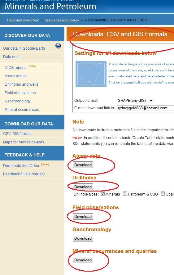
Hmmm that is how i got my shapefiles and i only had problems with Braidwood(corrupt data). Once you use the DL links a zip folder should be sent to your email. DL that and unzip the files then use local connect to upload them. For a shapefile of an area though there are normally more than 20 shapefiles.

When i get my son to sleep i will try to go through the process of uploading a shapefile and raster and see what happens.
 
I was told by NSW.gov that we have to convert these files from .ecw into .geotiff

i downloaded the app below , opened the metallogenic files , then click "save as" , save as type .geotiff , imported them into webconnect but for me they still wont show in GISRoam on Ipad

http://geospatial.intergraph.com/products/other/erdasermapper/erdaserviewer/Downloads.aspx

ready to throw this thing at the wall , i have a trip away bush planned in the morning and after 60 hours i still cant get it to play ball , the GISRoam tech support tell me i should be "converting them to .imagery files in LocalConnect" but where the hell do you change file formats in local connect or itunes ? ? ?

anybody need a concrete driveway broken up ? willing to do it using this Ipad as a hammer right about now.
 
You don't have to use web connect. Select the ecw or geotiff in local connect on your pc then process it there. Once it is processed open iTunes and stick it in the GISRoam folder, then open local connect in the app on your iPad and click load on your file. If you are still having trouble PM your phone number and I can help you through it.
There is a tutorial in the app on how to use local connect, click on the question mark.

DD
 
Can anyone send me files to import into GISRoam that they have already converted ?

The files i converted will not work with GISRoam in my Ipad mini , i gave up 2 months ago but now i have cooled down a bit i am going to give it another try

I am guessing the issue is the conversion process / file type i ended up with

NSW and W.A maps that show crown land , existing / past mining or exploration leases and geo / mineralogical data would be great if possible

thanks people
 
We are thinking of buying a Bluetooth gps for our ipad. I have found one that sounds good, but would like to know if anyone is using these devices and if so what Map Apps are you using?
Thanks
Anne
 

Latest posts

Top