-
Please join our new sister site dedicated to discussion of gold, silver, platinum, copper and palladium bar, coin, jewelry collecting/investing/storing/selling/buying. It would be greatly appreciated if you joined and help add a few new topics for new people to engage in.
Bullion.Forum
You are using an out of date browser. It may not display this or other websites correctly.
You should upgrade or use an alternative browser.
You should upgrade or use an alternative browser.
Victorian goldrush days maps
- Thread starter Mirrors
- Start date

Help Support Prospecting Australia:
This site may earn a commission from merchant affiliate
links, including eBay, Amazon, and others.
Mirrors
😎
malri_au
Steve
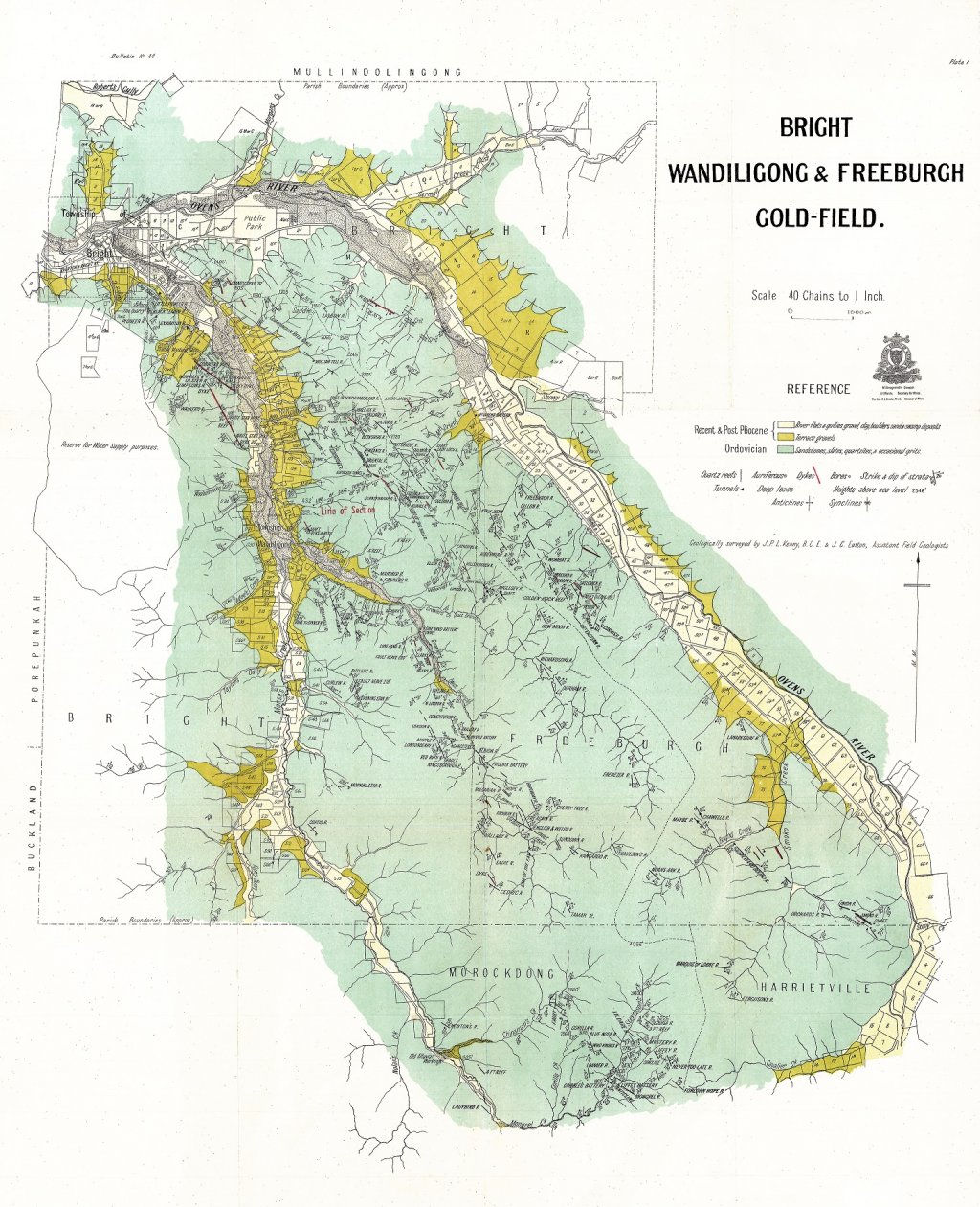
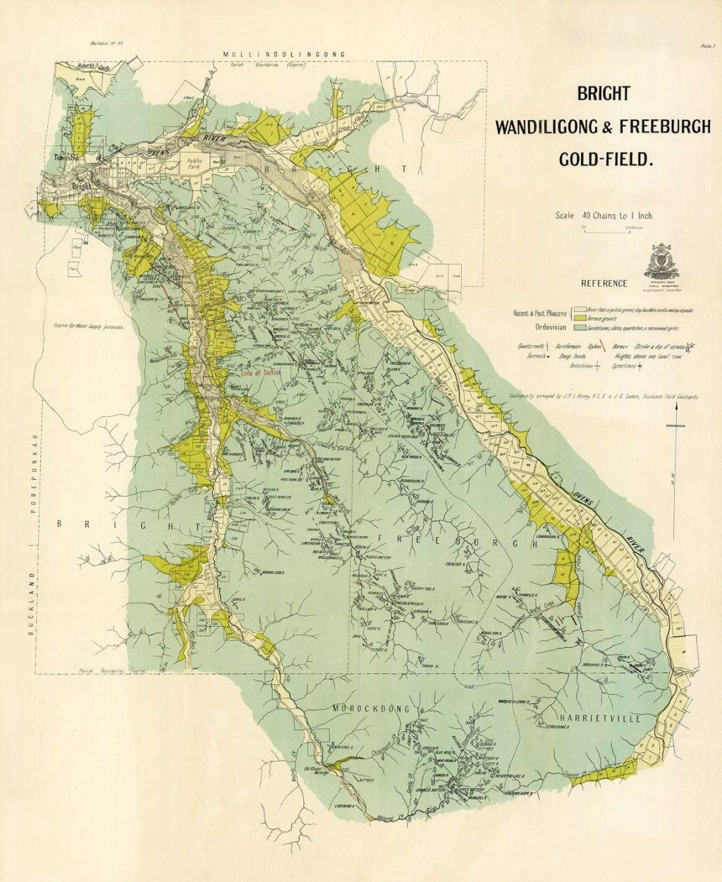
note the colour difference.same source,yet different source.

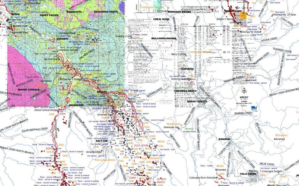
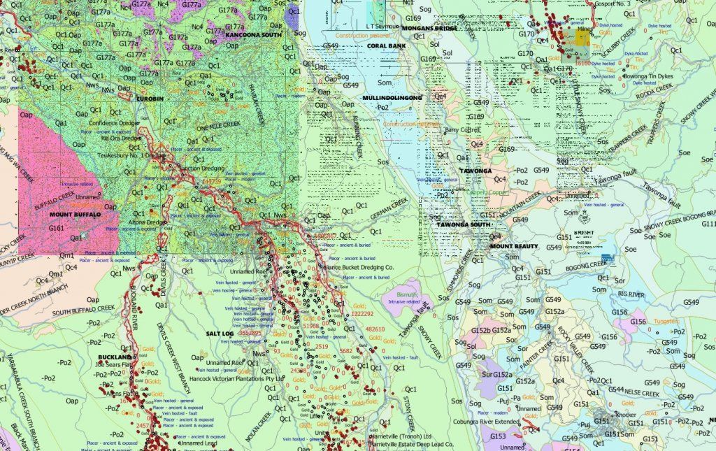
I also teach how to georeference these maps and place them inside geo software.

I much prefer the more modern maps,but it's good to cross check both.


I also teach how to georeference these maps and place them inside geo software.

I much prefer the more modern maps,but it's good to cross check both.

Mirrors
😎
The first map is identical
malri_au
Steve
except that one is higher quality than the other.there's a reason i asked if you picked up why the colour was different.
- Joined
- Nov 4, 2019
- Messages
- 18
- Reaction score
- 15
Is there anything like this available for NSW?
- Joined
- Jan 27, 2015
- Messages
- 7,758
- Reaction score
- 12,864
There's plenty of free NSW maps around.
https://hlrv.nswlrs.com.au
https://search.geoscience.nsw.gov.au/product/347
https://www.resourcesandgeoscience....geoscience-information/products-and-data/maps
https://www.records.nsw.gov.au/arch...rch/guides-and-indexes/gold-mining-guide#Maps
https://www.resourcesandgeoscience....aps/heritage-maps/distinguished-heritage-maps
https://www.resourcesandgeoscience....n/products-and-data/maps/mineral-deposit-maps
https://minview.geoscience.nsw.gov.au
- Joined
- Dec 26, 2019
- Messages
- 26
- Reaction score
- 32
Brilliant maps of Ballarat Thanx?
Mirrors
😎
:Y:
Sorry for 'digging up' an old post.
Im new to the forum, still working it all out.
Im wondering if anyone has heard of any maps from around melbourne north east? I am well aware there are PLENTY of old/abandoned mines in the area and shallow diggings aswel around old/ancient creeks.
I want to learn more about timelines of some of these places and how large some of the mines were..
Any help with maps or info would be great to have a read of over a coupke beers!
Cheers folks.
Mirrors
😎
Old maps I can help you with... where as in what area are you wanting to see ?
I have a few out that way
I have a few out that way
- Joined
- Mar 10, 2016
- Messages
- 7,955
- Reaction score
- 16,055
Rishey89 said:Sorry for 'digging up' an old post.
Im new to the forum, still working it all out.
Im wondering if anyone has heard of any maps from around melbourne north east? I am well aware there are PLENTY of old/abandoned mines in the area and shallow diggings aswel around old/ancient creeks.
I want to learn more about timelines of some of these places and how large some of the mines were..
Any help with maps or info would be great to have a read of over a coupke beers!
Cheers folks.
State Library :Y: haven't heard of them building a bar and staffing it with scantily clad women but their collective literature of Victoriastan history is good.
- Joined
- Feb 23, 2016
- Messages
- 4
- Reaction score
- 2
Hey mirrors,
Going for another thread dig.
Do you have any old maps on “Queenstown” (present day smiths gully and kangaroo ground/panton hill)
It’s hard to find old maps on the area
Going for another thread dig.
Do you have any old maps on “Queenstown” (present day smiths gully and kangaroo ground/panton hill)
It’s hard to find old maps on the area
Mirrors
😎
Let me have a look
Mirrors
😎
Mirrors
😎
Warrandyte.. ?
Mirrors
😎
They extend from souuth of Warrandyte to north of St Andrews. Why not just look on the GSV site yourself? Likewise there are a number on Tanjil-Russells Ck also on that site.Yes there are - see Geological parish plans
Similar threads
- Replies
- 6
- Views
- 833
- Replies
- 1
- Views
- 226
- Replies
- 2
- Views
- 596
- Replies
- 0
- Views
- 504
Latest posts
-
Small nugget find bungonia gorge anyone else tried there
- Latest: meanfreddy
-
-
where can i find the book bungonia to braidwood by Barry McGowan
- Latest: goldingthehardway
-
-
-
-


