Here's some reading that I did for WA Gold before my first trip West:
1. Have found gold in ground like that with only one small bit of Quartz every hundred feet.
If you look closely at the ironstone you'll notice two different types there, the jet black angular stuff is highly weathered BIF or Banded Ironstone Formation, the other is the common Laterite ironstone and the dirt is the broken down parts of both.
The gold in areas like these tends to be on the contact zone of the two types.
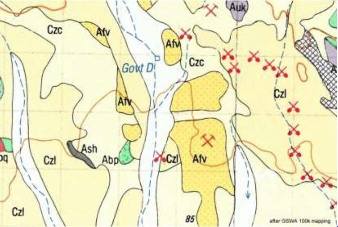
When looking for these types of areas on Geo Maps look for the Symbol "CZL"(ironstone gravel plains) & "Aci" (Banded Ironstone Formation BIF) and head for the contact zones of the two.
2. One of the common questions asked by prospectors looking at a geology map is: what rock has the gold in it? The answer is Czl, this is the geology map code for laterite. Usually the prospector will return frustrated and with nothing to show for their efforts after working a patch of laterite. Why is it that some laterites contain abundant gold and some contain nothing?
David Nixon, a Senior Exploration Geologist who currently works in an around Kalgoorlie, will explain what is it about the physical properties of gold and the features in the natural environment that the prospector can use to find gold easier.
Western Australian Museum Kalgoorlie Boulder
Unfortunately, I missed his lecture 


