There's many indicators in Victoria's gold fields and whilst they are easy to find sometimes we need a little extra help in getting to the bottom. I hope this little bit of info helps you in the field.

The humble Cherry tree (exocarpos cupressiformis) can help you find two things that can be usefully for both the eluvial prospector and the detectorist, 1 - shallow ground bedrock and 2 - gullies.
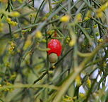
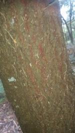
Its common to see the cherry tree in the goldfields due to the shallow nature of the ground, these cherry trees look like a cypress tree at a distance but up close have a similar bark to a ironbark with a red core. Whats significant about these cherry trees is that they are a parasite on eucalyptus trees their roots attach themselves to roots of other trees and drain water from them.

When you're in the bush and you've done some research, you know the area produced gold, you can see your indicators laying around everything is lined up accept you have limited time to detect so where do you start?
The main roots of eucalypts can grow 100 feet outward and generally stay in the top 12 inches of soil whilst only the tap root needs to go down and can go for 6 feet. The main root system will follow crevices and gullies which cant always been seen with the eye. The cherry trees will root right above these root systems to best exploit them.
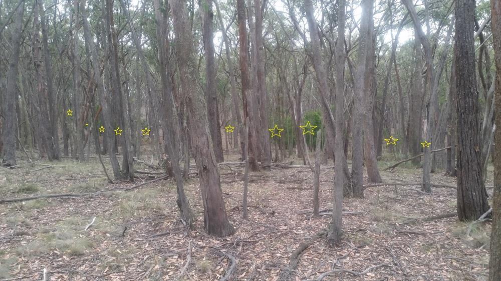
Sometimes a line will form and this is the power of the cherry tree, you now have an above ground visual of where water travels and or where the shallowest ground is to detect. It may be a gully, it may be a fault, it may just be flat step on a hill that for whatever reason is shallow ground, regardless this information can and will help you especially when detecting out bush.
Ive used these trees to pick a place to park for years and they more often than not lead me to good ground. I firmly believe the more you know about the bush you travel in the more info you will take in, the less likely you are to get lost and the more fun you'll have out there.
This first photo the gully is quite obvious I walked down this gully and found 40-50 shallow shafts, its not rocket science but there's 15 gullies on the way here and none of them had cherry trees.

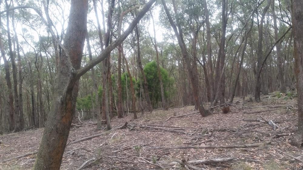
Here we are right on top of an adjacent ridge and the cherry trees pin pointed a fault with raised bedrock another great area to sample, it may aswell have been a big sign saying down here.

more info on exocarpos cupressiformis https://en.wikipedia.org/wiki/Exocarpos_cupressiformis

The humble Cherry tree (exocarpos cupressiformis) can help you find two things that can be usefully for both the eluvial prospector and the detectorist, 1 - shallow ground bedrock and 2 - gullies.
Its common to see the cherry tree in the goldfields due to the shallow nature of the ground, these cherry trees look like a cypress tree at a distance but up close have a similar bark to a ironbark with a red core. Whats significant about these cherry trees is that they are a parasite on eucalyptus trees their roots attach themselves to roots of other trees and drain water from them.

When you're in the bush and you've done some research, you know the area produced gold, you can see your indicators laying around everything is lined up accept you have limited time to detect so where do you start?
The main roots of eucalypts can grow 100 feet outward and generally stay in the top 12 inches of soil whilst only the tap root needs to go down and can go for 6 feet. The main root system will follow crevices and gullies which cant always been seen with the eye. The cherry trees will root right above these root systems to best exploit them.
Sometimes a line will form and this is the power of the cherry tree, you now have an above ground visual of where water travels and or where the shallowest ground is to detect. It may be a gully, it may be a fault, it may just be flat step on a hill that for whatever reason is shallow ground, regardless this information can and will help you especially when detecting out bush.
Ive used these trees to pick a place to park for years and they more often than not lead me to good ground. I firmly believe the more you know about the bush you travel in the more info you will take in, the less likely you are to get lost and the more fun you'll have out there.
This first photo the gully is quite obvious I walked down this gully and found 40-50 shallow shafts, its not rocket science but there's 15 gullies on the way here and none of them had cherry trees.

Here we are right on top of an adjacent ridge and the cherry trees pin pointed a fault with raised bedrock another great area to sample, it may aswell have been a big sign saying down here.

more info on exocarpos cupressiformis https://en.wikipedia.org/wiki/Exocarpos_cupressiformis


